
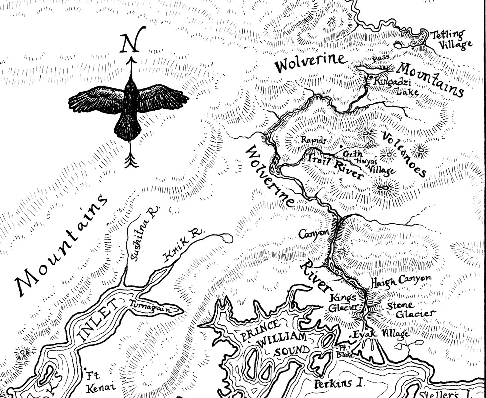
This is the map I drew for my friend and former coworker Eowyn Ivey’s second novel, To the Bright Edge of the World. It appears as a two-page spread in the American edition, and (much to my delight) is also printed on the front and back endpapers of the UK hardcover. I’ll admit I’ve bought books before for the sake of a good endpaper-map, so I get a real kick out of imagining a map I drew now lurking just undercover in bookstores everywhere, enticing casual browsers to read Eowyn’s story.
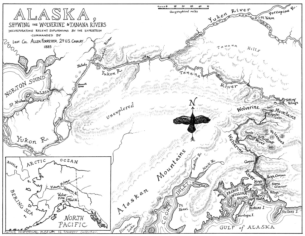
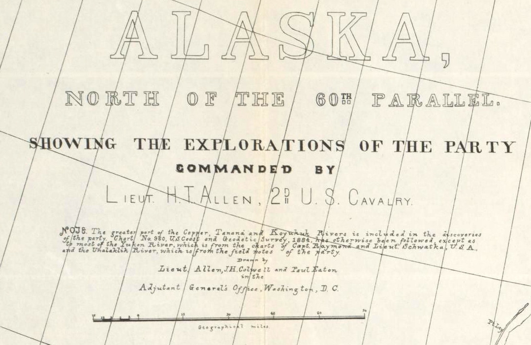
The fictional Lieut. Col. Allen Forrester’s 1885 expedition up the Wolverine River was inspired by the historical Lieut. Henry Allen’s 1885 expedition up the Copper River, so my map for the novel is a slightly altered version of the historical Allen map. Since readers will see the map before starting the story, the title is carefully worded to avoid giving away whether Forrester or any other members of the expedition actually survive to draw it themselves.
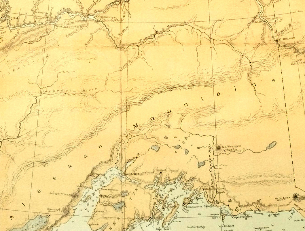
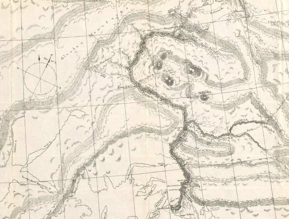
I mimicked the look and even the handwriting of the Allen map, but this Forrester map is a work of fiction – if the made-up place names don’t tip you off, then you should at least be suspicious that true north is marked by a trickster raven. Some place names (Unalaklik, Sushitna, Tetling) are true to spellings of the time, while others (like Perkins Island) are Eowyn’s inventions. (As long as we were playing loose with place-names, I took the liberty of renaming Kayak Island for Georg Steller, my favorite figure from the history of Alaskan exploration.) Like the historical Allen map, the Forrester map fills in from the 1884 USGS map of Alaska wherever the expedition didn’t survey in person. Unlike the Allen expedition, the Forrester group didn’t go up the Koyukuk River, so that area remains blank in this version. A couple details that are less fictional than they may appear: “Unexplored” comes straight from the 1884 USGS map, and “Mammoth bones” from a note further upriver on the Allen map (“Ice banks—Mammoth remains”).
My first version of the map had the Wolverine River and Trail River much more closely resembling the Copper and Chitina Rivers, but when I re-read the text I found that the travel times in the story required more space between the upper canyon and the start of the Trail River. After consulting more with Eowyn, I re-drew that whole area, and pulled the river further west while I was at it. The Wolverine River also appears in her first book, The Snow Child, where it’s a stand-in for the Matanuska River. I’m awfully attached to the notion that The Snow Child takes place in the woods and mountains of home, so in putting the Wolverine on a map, I put it as close to home as I could manage, given that this story pins the river’s mouth way over on the other side of Prince William Sound.
The fictional Lieut. Col. Allen Forrester’s 1885 expedition up the Wolverine River was inspired by the historical Lieut. Henry Allen’s 1885 expedition up the Copper River, so my map for the novel is a slightly altered version of the historical Allen map. Since readers will see the map before starting the story, the title is carefully worded to avoid giving away whether Forrester or any other members of the expedition actually survive to draw it themselves.
I mimicked the look and even the handwriting of the Allen map, but this Forrester map is a work of fiction – if the made-up place names don’t tip you off, then you should at least be suspicious that true north is marked by a trickster raven. Some place names (Unalaklik, Sushitna, Tetling) are true to spellings of the time, while others (like Perkins Island) are Eowyn’s inventions. (As long as we were playing loose with place-names, I took the liberty of renaming Kayak Island for Georg Steller, my favorite figure from the history of Alaskan exploration.) Like the historical Allen map, the Forrester map fills in from the 1884 USGS map of Alaska wherever the expedition didn’t survey in person. Unlike the Allen expedition, the Forrester group didn’t go up the Koyukuk River, so that area remains blank in this version. A couple details that are less fictional than they may appear: “Unexplored” comes straight from the 1884 USGS map, and “Mammoth bones” from a note further upriver on the Allen map (“Ice banks—Mammoth remains”).
My first version of the map had the Wolverine River and Trail River much more closely resembling the Copper and Chitina Rivers, but when I re-read the text I found that the travel times in the story required more space between the upper canyon and the start of the Trail River. After consulting more with Eowyn, I re-drew that whole area, and pulled the river further west while I was at it. The Wolverine River also appears in her first book, The Snow Child, where it’s a stand-in for the Matanuska River. I’m awfully attached to the notion that The Snow Child takes place in the woods and mountains of home, so in putting the Wolverine on a map, I put it as close to home as I could manage, given that this story pins the river’s mouth way over on the other side of Prince William Sound.
 RSS Feed
