Greetings, denizens of the Internet! I have here a little blog; I suppose it would be good if I wrote in it once in a while. Maybe once I get in the habit of updating regularly, I can start handing out my business card without apologizing for the dismal state of my website.
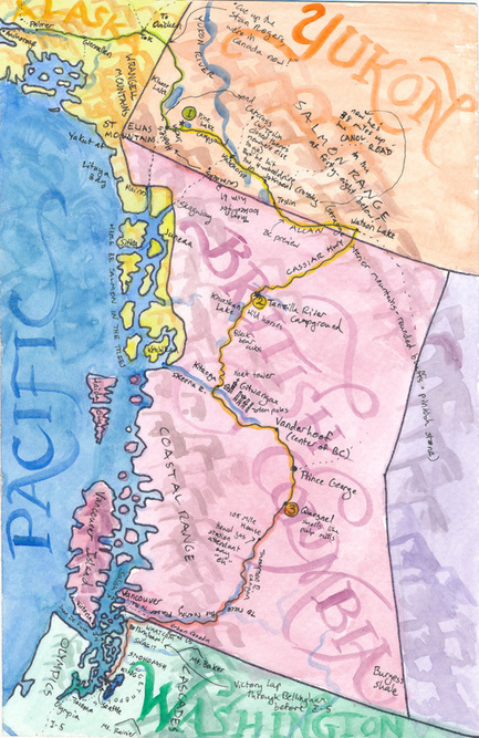
For your amusement, to start things off, here's a map I drew on a postcard and sent to my aunt and uncle a little over a year ago, after I moved to Seattle. Hand-drawn memory maps are a hobby of mine. You think you know your geography until you try to draw the US and can't for the life of you come up with a Nebraska-shaped hole where Nebraska ought to maybe be. This one of the road from Palmer to Seattle is more accurate than some, mostly because I'd spent four days with the Milepost map while driving down, and that was still fairly fresh in my mind when I drew it.
Some of the small text that will be hard to read in this image:
(at the Canadian border): "Cue up the Stan Rogers, we're in Canada now!"
(scrawled geographically, with arrows, all over lower Yukon Territory):
They looked for him in Carmacks --> Haines (Jnctn) --->
and Carcross (w/ Teslin closed there's nowhere else to go)
But he hit the 4 wheel drive in Johnson's Crossing ---->
now he's 38 miles up the CANOL ROAD
in the SALMON RANGE at forty-eight below!
(along the road in BC): Wild horses - black bear cubs - neat tower - Quesnel smells like pulp mills - 108 Mile House - heard gas station attendant say "eh"
(along the Fraser River): To race the roaring Fraser to the sea
Careful observers will note that Stan Roger's "Northwest Passage" album was on heavy rotation for this trip.

 RSS Feed
